Images of World Impact Craters
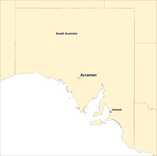
ACRAMAN IMPACT STRUCTURE - SOUTH AUSTRALIA
| Crater Name(s) | Acraman Impact Structure | |
| Country | Australia | |
| Longitude | 135 deg 27 min E | |
| Latitude | 32 deg 01 min S | |
| Diameter (km) | 40 -90 km | |
| Age | ca 580 Ma | |
| Impact Origin Evidence | Shocked mineral grains, shatter cones, impact melt and distal ejecta | |
| Description | The Acraman impact structure is a deeply eroded impact site with estimates of the depth of erosion to be about 2.5 km. The structure has a distinctive aeromagnetic signature and is expressed topographically as an approximately 30km diameter depression in the Gawler ranges of South Australia. | |
| Landsat Scene | Path 100 Row 82 | |
| References | Haines P W. 2012. Impact Cratering and Distal Ejecta: The Australian Record. Australian Journal of Earth Science, 52, p. 481-507. Wallace M W, Gostin V A and Keays R R. 1996. Sedimentology of the Neoproterozic Acraman impact-ejecta horizon, South Australia. AGSO Journal of Geology & Geophysics, 16 (4), p. 443-451. Dyson I. 2005. Tsunamis and Super-Hurricanes after the Acraman Asteroid Impact. MESA Journal, 39, p.10-13. |
|
| Date Data Entered | 2014 09 17 |
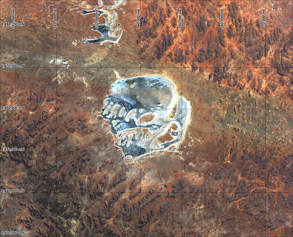
Landsat 8 image of the Acraman Impact Structure (pansharpened RGB Bands 4, 3 and 2). Coordinates WGS84 UTM zone 53 South.
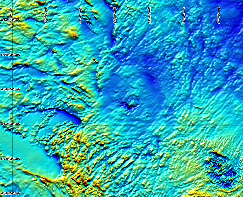
Shaded Total Magnetic Intensity image of the Acraman Impact Structure (note circular de-magnetised zone). Coordinates WGS84 UTM zone 53 South..
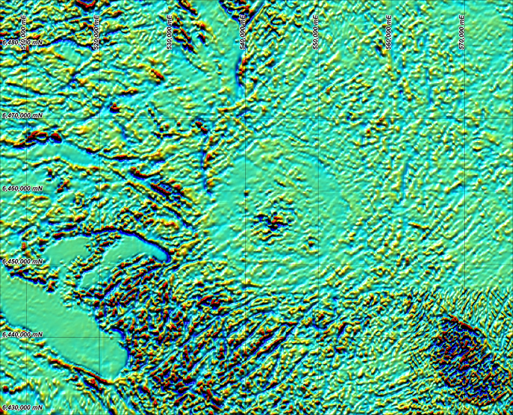
First Vertical Derviative Image of the Total Magnetic Intensity over the Acraman Impact Structure (note circular de-magnetised zone). Coordinates WGS84 UTM zone 53 South..